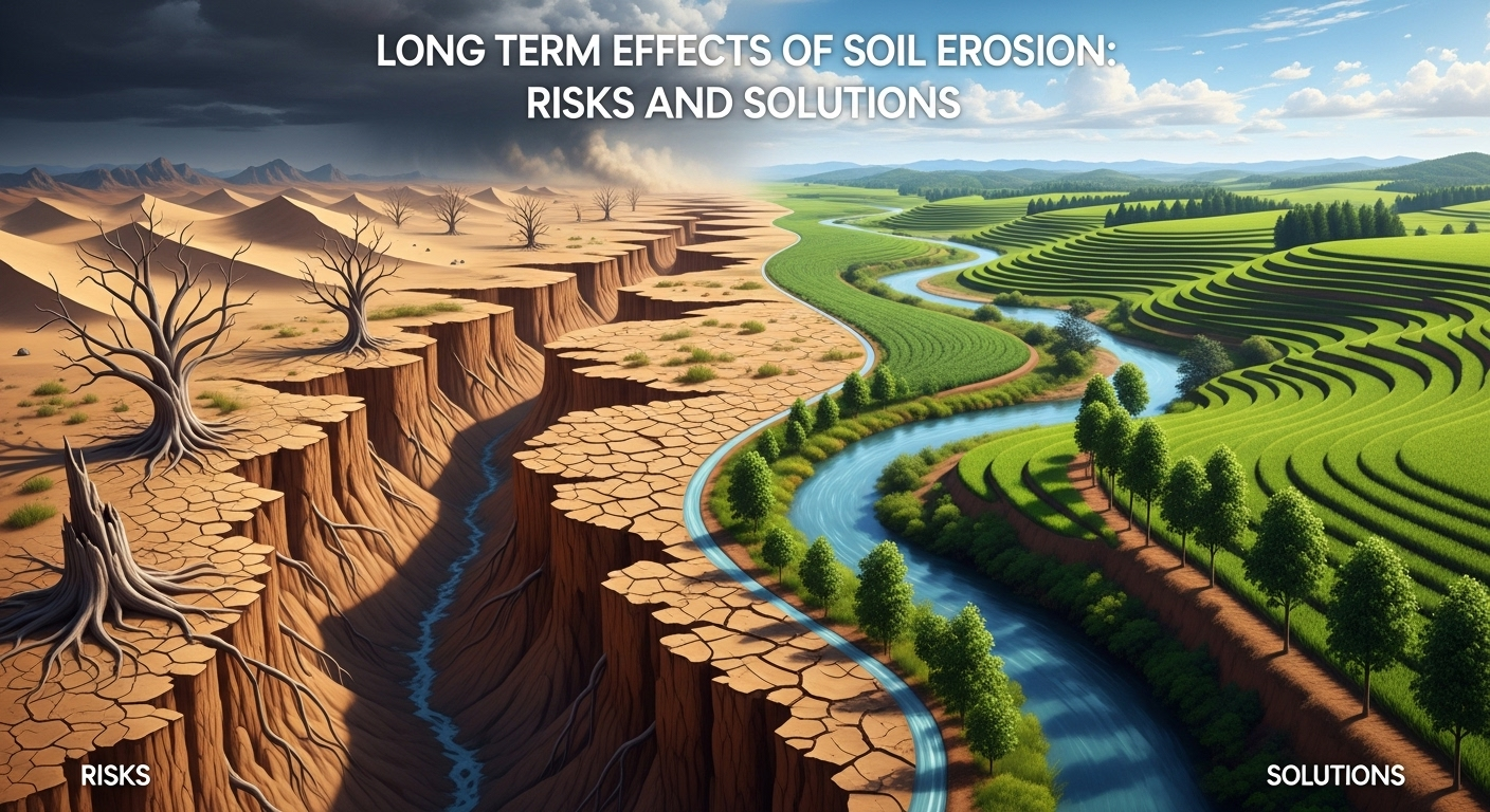
Long Term Effects of Soil Erosion: Risks and Solutions
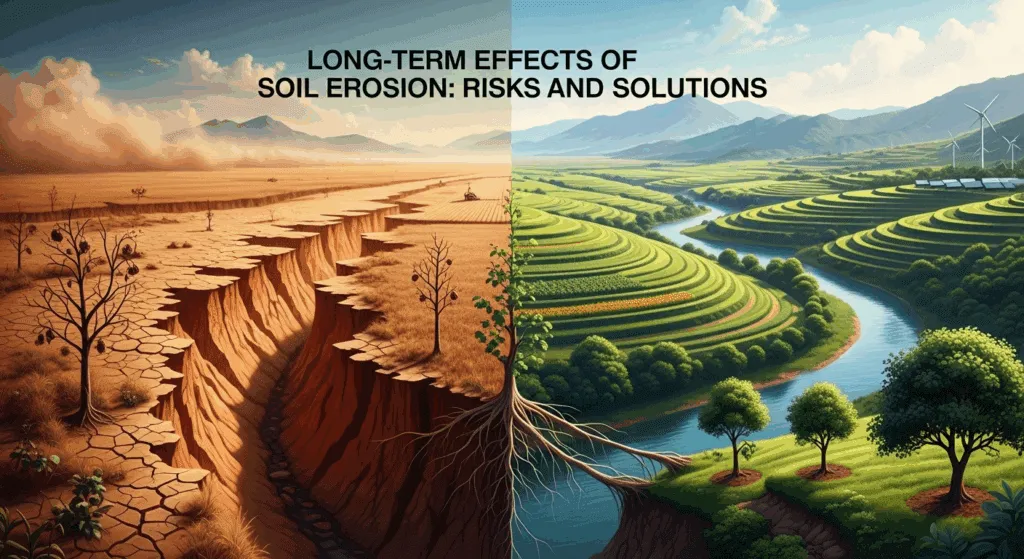
Understanding the long term effects of soil erosion is essential for farmers, planners, policymakers, and anyone who depends on clean water and reliable food supplies—which is to say, all of us. Soil erosion is not just a seasonal nuisance; it is a slow-moving crisis that accumulates over decades, irreversibly stripping landscapes of fertility, biodiversity, and resilience. This article explains the risks and the solutions using the latest evidence and best practices so you can make decisions that stand the test of time.
H2: What Soil Erosion Is—and Why It Keeps Getting Worse
Soil erosion is the detachment and movement of soil particles by water, wind, or tillage. While a small amount of erosion is natural, human activity has amplified the rate and scale, converting healthy topsoil into sediment that clogs rivers, reservoirs, and coastal zones. The result is a long-term decline in soil function, productivity, and ecosystem stability.
Globally, estimates suggest billions of tons of soil are lost each year, with losses concentrated on croplands and overgrazed rangelands. The most damaging losses occur from the top few inches of soil, where organic matter, nutrients, microbes, and fine aggregates provide most of the biological and agronomic value. Once that layer is gone, recovery can take centuries—if it happens at all.
The persistence of erosion stems from structural pressures: expanding food demand, extreme rainfall and drought cycles, and incentives that reward short-term yield over long-term soil health. This section explains the processes that drive erosion, setting up the deeper dive into impacts and solutions.
H3: 1) Primary Drivers: Climate, Land Use, and Management
Erosion intensifies when climatic stress meets vulnerable land cover. More frequent high-intensity storms increase runoff, while longer dry spells leave bare soil more exposed to wind. Land clearing, overgrazing, and frequent tillage reduce protective cover and break soil aggregates, creating conditions where raindrops and wind shear can detach particles more easily.
Management practices often amplify those forces. Conventional tillage pulverizes soil, reducing infiltration and increasing surface sealing; steep-slope farming without terraces accelerates downslope soil transport; and poor road drainage channels runoff into gullies. In many regions, the removal of hedgerows and riparian vegetation has eliminated critical landscape buffers that once trapped sediment and slowed water.
H3: 2) Erosion Pathways: Splash, Sheet, Rill, Gully, and Wind
Erosion begins with splash impact when raindrops hit bare soil, dislodging particles. As water flows, sheet erosion skims soil from broad areas, then concentrates into rills (small channels) and eventually gullies that can slice through fields and hillsides. Each step increases the energy and volume of sediment transport.
Wind erosion follows a similar energy gradient. When surface cover is sparse and soil is dry and fine-textured, wind can move particles by saltation (bouncing) and suspension (airborne dust), stripping organic matter and leaving behind coarser, less fertile material. Over time, both water and wind erosion coarsen the soil, reduce water-holding capacity, and leave hardpans or crusts that further reduce infiltration.
H2: The Long-Term Ecological and Agricultural Impacts
The long-term impacts of erosion accumulate silently. Productivity declines slowly at first, then more steeply as topsoil thresholds are crossed. Ecosystem services—from water filtration to pollinator habitat—contract. These changes are expensive to reverse and some are functionally irreversible on human timescales.
Agriculture bears the brunt. Soil fertility is not just a bag of nutrients; it’s a living system that supplies moisture buffering, nutrient cycling, and disease suppression. Erosion undermines all three. Farther downstream, the consequences spread to fisheries, reservoirs, and municipalities that must treat sediment-laden water, shifting costs from farms to public budgets.
Ecologically, erosion fragments habitats and alters stream morphology. Sediment-sensitive species decline, while opportunistic and invasive species gain ground. The cumulative effect is a loss of landscape resilience to climate extremes, pests, and wildfire.
H3: 1) Declining Soil Fertility and Crop Yields
Topsoil erosion removes the richest fraction of soil organic carbon (SOC), clay, and silt—components that store nutrients and water. As SOC declines, soils lose structure (aggregate stability), infiltration falls, and plants face more drought stress even when rainfall totals haven’t changed. Farmers often respond with more fertilizer and irrigation, raising costs and environmental risk.
Over decades, yield trends can flatten or reverse, especially on slopes. Research and farm records commonly show higher inter-annual yield variability on eroded fields because the buffering capacity is reduced. This volatility matters as climate extremes become more frequent, threatening long-term farm viability.
H3: 2) Biodiversity and Soil Life Loss
Erosion simplifies soil habitats, reducing pores and microaggregates that shelter microbial and mesofaunal communities. With fewer niches and less organic matter, beneficial organisms that drive nutrient cycling and disease suppression decline. Aboveground biodiversity also suffers when hedgerows and field margins are removed, reducing corridors for pollinators and natural enemies of pests.
Over time, landscapes become more homogeneous and less resilient. Local extinctions of sensitive species can cascade, eroding ecosystem functions like pollination, predation, and decomposition. Rebuilding those functions requires both soil restoration and habitat reconnection.
H3: 3) Water Quality Degradation and Sedimentation
Sediment is a leading cause of impaired waters. As eroded particles enter streams, they carry attached nutrients and contaminants (phosphorus, pesticides, heavy metals). This can produce algal blooms, hypoxia, and drinking water challenges. Reservoirs lose storage capacity as sediment accumulates, shortening infrastructure lifespans and increasing dredging needs.
Once sediments settle in riverbeds and deltas, they alter flow patterns, increase flood risk, and degrade spawning grounds. The costs are borne by fisheries, utilities, and communities far from the original erosion source, illustrating why erosion is a basin-wide problem requiring basin-wide solutions.
H2: Climate Feedback Loops and Carbon Accounting
Erosion interacts with climate change in both directions. More intense rainfall and drought cycles accelerate soil loss, while erosion-driven carbon emissions feed back into the climate system. Long-term mitigation must therefore address soil as a critical carbon pool.
When topsoil is lost, the carbon that once was stored in stable aggregates can be oxidized to CO2. Dust from wind erosion can also darken snow and ice surfaces, lowering albedo and amplifying regional warming. Conversely, restoring soil cover and structure increases surface reflectivity and cools local microclimates, improving moisture retention and crop resilience.
H3: 1) Soil Organic Carbon Loss and Emissions
SOC is protected inside microaggregates. Erosion breaks those aggregates and transports the finest, carbon-rich fraction away. Some carbon re-buries downslope or in sediments, but a significant portion oxidizes, adding to atmospheric CO2. Over decades, this depletes one of the world’s largest terrestrial carbon stocks.
Rebuilding SOC through cover crops, reduced tillage, manure/compost additions, and perennial systems can reverse the trend. These practices simultaneously reduce erosion by maintaining year-round cover and enhancing aggregate stability, creating a virtuous cycle of carbon gain and erosion control.
H3: 2) Dust, Albedo, and Weather Extremes
Windborne dust affects radiation balance and cloud formation. Dust settling on snowfields reduces albedo, speeding melt and altering water availability downstream. At regional scales, dust can suppress precipitation or shift storm tracks, compounding drought stress in agricultural zones.
Long-term programs that increase ground cover—such as agroforestry, shelterbelts, and conservation set-asides—reduce dust emissions. The benefits extend beyond fields to public health (reducing particulate matter) and hydropower reliability by stabilizing seasonal flows.
H2: Measuring and Monitoring Erosion for the Long Term
You cannot manage what you don’t measure. Effective erosion management depends on monitoring soil condition, detecting hotspots, and tracking whether interventions are working. Modern approaches combine field indicators with remote sensing and modeling to provide a multi-scale view.
At the field level, farmers can track simple indicators—residue cover percentage, infiltration rate, aggregate stability, and SOC tests. At watershed and regional scales, satellite imagery detects bare soil, vegetation cover, and sediment plumes in water bodies. Models estimate long-term risk and help target conservation investments.
The key is continuity: repeated measurements over years to see trends across seasons and cropping cycles. The table below summarizes common metrics and their value to decision-making.
Table: Long-Term Monitoring Metrics and What They Tell You
- Metric: Soil Organic Carbon (SOC) • What it indicates over time: Fertility, structure, carbon stock • Typical tools/notes: Lab tests, proximal sensors; track every 1–3 years
- Metric: Infiltration rate • What it indicates over time: Runoff/erosion risk, water-holding • Typical tools/notes: Double-ring infiltrometer, rainfall simulator
- Metric: Aggregate stability • What it indicates over time: Resistance to detachment/crusting • Typical tools/notes: Wet sieving kits; sensitive to management changes
- Metric: Ground cover (%) • What it indicates over time: Exposure to raindrop/wind energy • Typical tools/notes: Field surveys, smartphone apps, drones
- Metric: Sediment yield at outlets • What it indicates over time: Catchment-scale erosion trend • Typical tools/notes: Turbidity sensors, sediment traps, rating curves
- Metric: RUSLE/USPED risk index • What it indicates over time: Spatial risk targeting • Typical tools/notes: GIS with DEMs, rainfall erosivity datasets
H3: 1) Field Diagnostics and Simple Indices
Farmers and land managers can start with low-cost diagnostics. A shovel test reveals horizon thickness and compaction; infiltration tests show whether soil can accept storm rainfall; residue cover measurements show immediate exposure risk. Over time, tracking SOC, pH, and cation exchange capacity gives a picture of fertility resilience.
These indicators connect directly to management choices. If infiltration is poor, reduce tillage and increase cover crop root density. If SOC is stagnant, add organic amendments and diversify rotations. When these changes are monitored consistently, adaptive management becomes data-driven rather than guesswork.
H3: 2) Remote Sensing, Drones, and Models
Satellites provide frequent, large-area snapshots of vegetation indices and bare soil exposure. Drones fill the gap with higher-resolution imagery for field edges, gullies, and buffer strips. Combined with digital elevation models, managers can predict where rills will form and place interventions precisely.
Models like RUSLE help estimate average annual erosion based on rainfall erosivity, soil erodibility, slope length/steepness, cover, and practices. When regularly updated with new data, these tools guide investment to the highest-return areas, making conservation more cost-effective.
H2: Solutions: Prevention, Mitigation, and Landscape Restoration
The best time to stop erosion is before the soil moves. The second-best time is now. Solutions work best as integrated systems—farm-level practices combined with landscape buffers and enabling policies. This section organizes options you can apply and scale.
On-farm, the priority is to keep soil covered, rooted, and aggregated. At landscape scale, reconnect riparian corridors, reforest steep slopes, and slow water with natural infrastructure. Policy can then align incentives so good practices are the default rather than the exception.
Because erosion drivers vary by climate, soil, and topography, build a local “portfolio” of practices and iterate using monitoring feedback. The following subsections outline practical choices with long-term payoffs.
H3: 1) On-Farm Practices That Deliver
- Conservation tillage and no-till: Minimize soil disturbance to preserve aggregates and pores. Expect improved infiltration and residue retention that dampens runoff energy.
- Cover crops and living mulches: Year-round cover shields soil from raindrop impact, feeds soil biota, and increases SOC. Diverse mixes improve nutrient scavenging and root architecture.
- Contour farming and terracing: Farming along contours reduces slope length; terraces break slope into short, flat steps, sharply reducing flow velocity.
- Nutrient and pH management: Optimized fertility strengthens root systems and ground cover, indirectly reducing erosion risk while boosting yields.
- Precision traffic and controlled wheel tracks: Limits compaction to designated lanes, protecting the rest of the field’s infiltration capacity.
Over time, these practices stack benefits: less runoff, more moisture storage, and higher resilience to droughts and deluges. While transitions may require equipment changes or learning curves, the long-term cost per acre typically declines as inputs and repairs drop.
H3: 2) Landscape and Watershed Measures
- Riparian buffers and filter strips: Vegetated zones trap sediment and nutrients, lower stream temperatures, and provide habitat corridors.
- Reforestation and shelterbelts: Trees stabilize slopes, anchor dunes, and reduce wind speed at the surface, cutting wind erosion and evapotranspiration stress.
- Check dams and grade-control structures: Small, distributed barriers slow water, promote sediment deposition, and reduce gully incision.
- Constructed wetlands and floodplains: Restored water storage reduces peak flows, traps sediments, and improves downstream water quality.
These measures work best together. For example, upstream terraces coupled with mid-slope buffers and downstream wetlands form a cascading defense that reduces erosion and flood damage while boosting biodiversity.
H3: 3) Policy, Finance, and Market Incentives
Policies that pay for performance—measured via cover metrics, SOC gains, or reduced sediment at catchment outlets—align private incentives with public benefits. Conservation easements, tax credits, and cost-share programs can bridge the adoption gap.
Emerging carbon and water quality markets add revenue streams for practices that sequester carbon or reduce nutrient runoff. When contract terms recognize the multi-year timeline of soil rebuilding, farmers are more likely to sustain practices beyond pilot periods, turning short-term projects into long-term stewardship.
H2: Economic Costs, Hidden Liabilities, and ROI of Action
Erosion silently inflates operating costs and compresses margins. Even modest topsoil losses increase fertilizer needs, irrigation frequency, and machinery wear from rougher fields and rills. Off-farm, municipalities and utilities spend more on water treatment and dredging—costs ultimately borne by taxpayers and ratepayers.
Quantifying these costs clarifies the value of prevention. A field that loses a fraction of an inch of topsoil per year may see incremental yield decline that only becomes obvious after a decade, but the cumulative nutrient loss and reduced moisture buffering can exceed the cost of cover crops and conservation tillage many times over.
Investments in erosion control often have multi-benefit ROI: increased yield stability, reduced insurance payouts, lower sediment management costs, and better ecosystem services. The table below summarizes typical timelines.
Table: Timeline of Benefits from Erosion Control Investments
- 0–1 years: Reduced runoff and visible rilling; improved field trafficability after storms; slight residue increase
- 1–3 years: Higher infiltration, fewer ponding issues; initial SOC uptick; reduced fertilizer loss and better nutrient-use efficiency
- 3–5 years: Noticeable yield stability in wet/dry years; reduction in sediment at drainage outlets; improved water quality metrics
- 5–10 years: Measurable SOC gains; lower input costs; stabilized gullies; enhanced biodiversity and pollinator presence
- 10+ years: Significant topsoil recovery where feasible; long-term resilience to climate extremes; strong carbon balance and market-ready credits
H3: 1) Cost-Benefit Framing That Resonates
Frame decisions around risk-adjusted returns. Practices that reduce yield volatility can be more valuable than practices that only raise average yield, particularly in climates with growing extremes. Add avoided costs (dredging, drainage repairs) and co-benefits (carbon credits, habitat compliance) to the analysis.
Budget for transition years. Some practices, like shifting to no-till with covers, may require new equipment or management. Grants, low-interest loans, and technical assistance can smooth the curve until savings and yield stability accrue.
H3: 2) Scaling What Works
Pilot in high-risk subfields identified by models or monitoring, then scale laterally. Use producer networks and cooperative groups to share equipment (e.g., seeders for cover crops) and knowledge. Public-private partnerships can finance watershed-scale buffers and wetlands when downstream beneficiaries contribute.
Finally, embed monitoring from day one. Clear KPIs—cover percentage, infiltration rate, SOC—keep teams accountable and enable adaptive management. Over time, the data itself becomes an asset for accessing green finance and certifications.
H2: Governance, Standards, and Long-Term Stewardship
Erosion is a cross-jurisdictional problem. Upstream decisions affect downstream communities and ecosystems. Coherent governance systems align farm programs, water quality standards, and land-use planning so that conservation decisions are coordinated rather than piecemeal.
Standards and frameworks—such as land degradation neutrality targets and watershed TMDLs—provide measurable goals. Certification schemes and supply-chain sourcing policies can amplify adoption when buyers reward verified soil stewardship.
Long-term stewardship depends on continuity. Programs that survive election cycles, and funding that persists across droughts and floods, keep practitioners engaged. Building institutions that coordinate across agencies and watersheds is essential for durable results.
H3: 1) Data Transparency and Accountability
Open, accessible data on sediment loads, water quality, and land cover helps communities target resources and verify outcomes. Shared dashboards can align stakeholders—from farmers to utilities—to a common set of indicators and timelines.
Verification protocols for carbon and water credits should be rigorous but practical. Combining remote sensing with field audits balances cost and credibility, enabling markets to scale without sacrificing integrity.
H3: 2) Education, Extension, and Cultural Change
Knowledge transfer is a decisive factor. Farmer-to-farmer learning, extension services, and vocational training spread practices faster than top-down mandates. Celebrating local champions and integrating soil health into school curricula fosters a stewardship culture.
Language and framing matter. Emphasize profitability, risk reduction, and legacy. In many regions, the ethos of caring for the land—custodianship—resonates more deeply than compliance-based messaging.
H2: FAQs: Long-Term Effects of Soil Erosion
Q: What are the most significant long-term effects of soil erosion?
A: The biggest impacts include persistent yield decline, loss of soil organic carbon and fertility, reduced water infiltration, degraded water quality from sediment and nutrient loading, and increased flood and drought vulnerability. Over decades, these effects reduce food security and ecosystem resilience.
Q: How does erosion affect climate change?
A: Erosion accelerates the loss of soil organic carbon, contributing to CO2 emissions. Wind-blown dust can alter albedo and weather patterns. Conversely, erosion control practices often increase carbon sequestration and improve local climate resilience.
Q: Can eroded soils be restored?
A: Partially. Practices like cover crops, reduced tillage, compost additions, and reforestation can rebuild organic matter and structure, but fully replacing lost topsoil can take decades to centuries. Prevention remains the most cost-effective strategy.
Q: Which practices reduce erosion fastest?
A: Maintaining surface cover is the quickest win—cover crops, crop residues, and mulches immediately reduce raindrop impact and runoff. On slopes, contouring and terraces produce rapid reductions in soil loss. Riparian buffers trap sediment where runoff concentrates.
Q: How do I measure progress without expensive equipment?
A: Track a few simple indicators annually: residue cover percentage, infiltration rate with a basic test, and SOC with periodic lab tests. Photograph fixed points each season to document visual changes in cover and rills.
Q: Is soil erosion only a rural issue?
A: No. Construction sites, unpaved roads, and urban runoff contribute substantial sediment loads. Urban green infrastructure—rain gardens, permeable pavements, and vegetated swales—plays a crucial role in reducing erosion and sediment transport.
H2: Conclusion: Turning the Tide on Erosion Requires Persistence and Partnership
The long-term effects of soil erosion are cumulative, systemic, and costly—but they are not inevitable. By keeping soil covered, rooted, and aggregated, and by reconnecting landscapes with buffers and wetlands, we can restore the functions that make agriculture and ecosystems resilient. Measured, adaptive management—grounded in simple field indicators and modern sensing—lets us invest where the returns are greatest.
With aligned policies and market incentives, the economics are favorable: fewer input losses, more stable yields, and lower public costs for water and infrastructure. In the end, protecting soil is not just an agronomic practice; it is a societal insurance policy against climate extremes, food insecurity, and environmental degradation. The path forward is clear: prevent, protect, and rebuild—with the patience and consistency that living systems require.
Summary
This comprehensive guide explains the long-term effects of soil erosion and how to address them. It outlines the ecological, agricultural, and societal risks—declining fertility and yields, biodiversity loss, water quality degradation, and climate feedbacks—while detailing practical solutions from farm-level practices (cover crops, no-till, contouring) to watershed measures (buffers, reforestation, wetlands). The article emphasizes monitoring (SOC, infiltration, aggregate stability) and data-driven targeting using remote sensing and models. It also covers the economics and governance needed for lasting impact, showing how prevention and restoration deliver strong, multi-benefit returns over time.
